Exploration mode = ON! A team of 4 leaves to survey Allen Bay Formation mountain tops for patterned ground, felsenmmers and subglacial channels.
With @drcrater, @agraugal and Dr. Jellinek, we started the day on ATV's toward the south-east, relative to base camp location, for a long day exploring the intrinsic of subglacial channels, the main research focus of Ph. D. student A. Grau. Ancient subglacial channels are the relict of a time when glaciers or an ice cap was covering the area before the ice retreated on central Devon Island, 8800 to 8500 years before present (Dyke, 1998). At first glance, subglacial channels look like a usual riverine or fluvial channel... or are they? When looking closely, a few obvious differences are striking, for example:
Due to this river being under a layer of glacier ice, pressure may be exerted on the subglacial stream, possibly resulting in bed topography gaining altitude in the downstream direction;
Subglacial channels may be parallel, and quite close one from another;
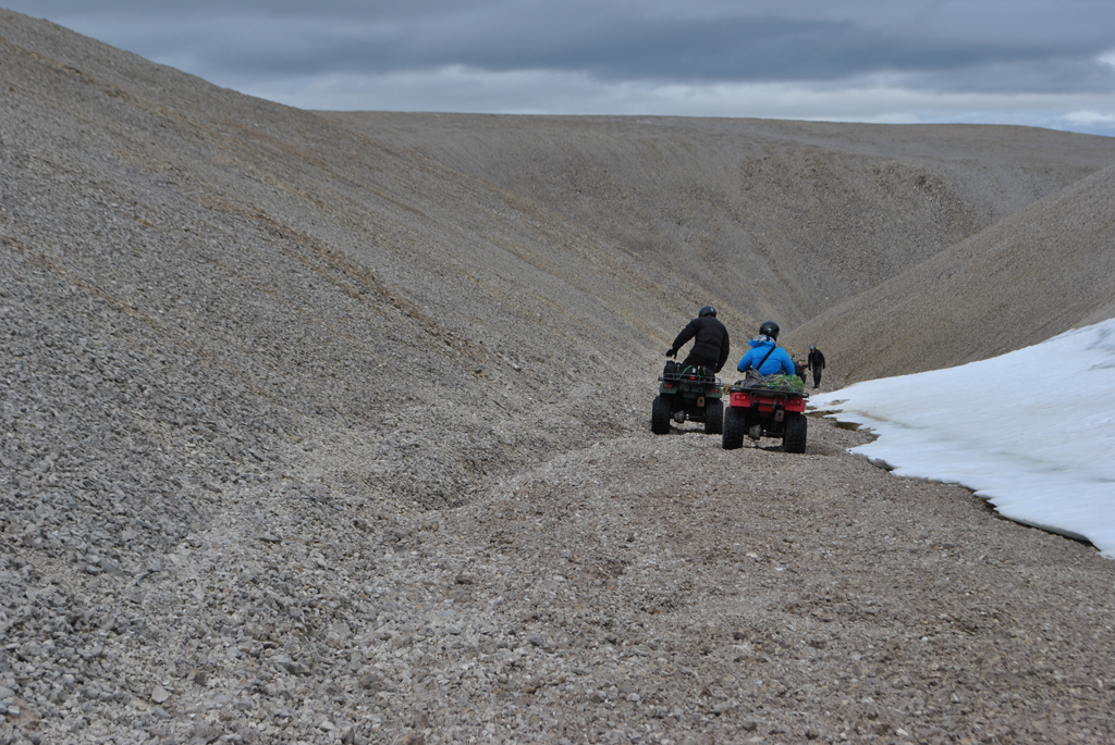
The goal of today's work is to find a few subglacial channels and cartography the long profile of the channels to later analyze their geometry and distribution in a geographical information system. Here (Figure 1) we are busy mapping this channel.
Being able to recognize the nature of such channels in cold, but non-glaciated environments is useful to understand ancient climate conditions, either in polar regions, or on Mars, for instance.
Figure 1: A few members of our team getting ready to map the longitudinal profile of a possible subglacial channel.
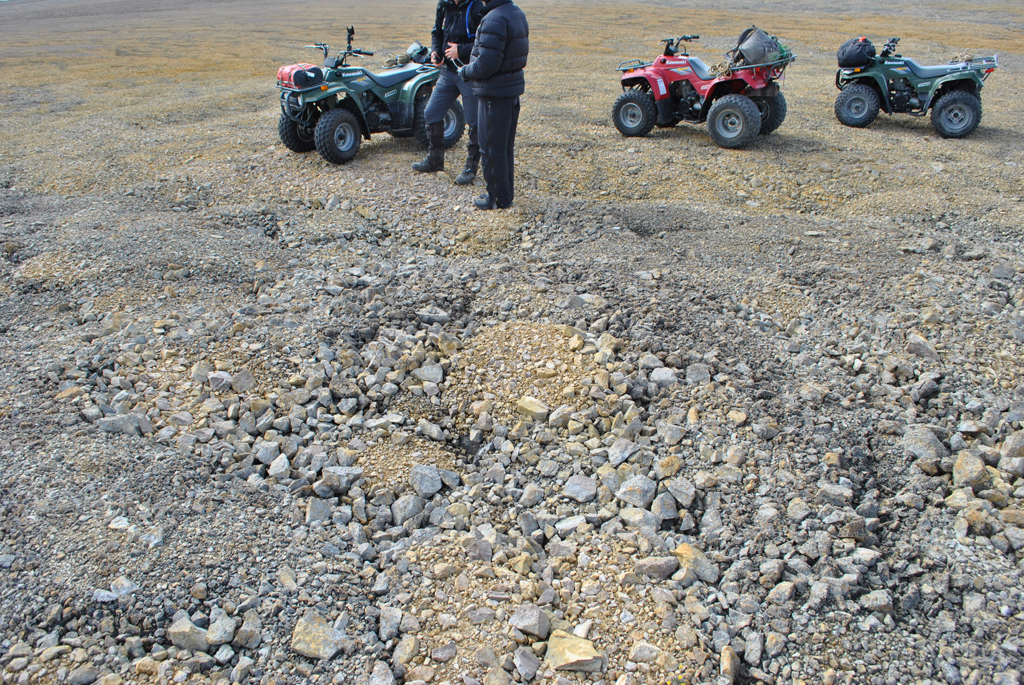
While travelling from one channel to another, we stumbled upon awesome frost-shattered rock mantles, also known as felsenmeers, featured by patterned ground due to the frost action, one of the top interests of mine (Figure 2). I will have to return here to study and characterize the nature of this patterned ground if possible.
Figure 2: Sorted patterned ground forming on plateaus-top. Small sized rock fragments and finer sediments are found in the center of the stone circle, where coarser material was pushed outside toward the rims.
We departed late - and the sun was at the rendez-vous, in addition to an almost fully operational camp already.
The last group (@Elusieum, @planet_neish, @meteorJen and I) went in the Twin Otter around 22:30, after refueling from their first run and after loading it. The aircrafts were back from their first run to drop team one and two and their gear on the site. Overall, it took approximately 40 to 45 minute to fly near our camp site, about 20 minute to empty, and another...
A rainy evening. Everyone eager to get at destination.
Everyone is near the tarmac, in full expedition gear, ready to leave to Devon. Light rain, sky is gray, it is frisky as usual. We just got a GO from the PCSP control. We spent the last two days making and weighing boxes, as everything getting in the taxi need to be known up to the nearest 10 kg by the pilot - when we were allowed a bit less than 1.5 tons, passengers included. So...
Resolute Bay - my first time ever on Cornwallis Island; and I will finally meet the PCSP staff in person, after all these years over the long-wave radio and Iridium!
Just arrived at Resolute Bay, Nunavut, yesterday. This is presently my first time on Cornwallis Island and also the most northern location I ever went. Polar Continental Shelf Program Resolute facility is an invaluable resource for researchers working in the High Arctic (15 July 2016). In fact this place is amazing, seriously, in regard with the logistics provided and their support for our research. Staff from PSCP (Salut Yvon!)...
This is it. Devon Island it will be! This will be quite something - as I never had the chance to visit a polar desert before. Most places I went to were quite green and wet (wetlands). Also every place I visited up to now is located south of Devon Island too.
Here is a map of the location of our projected fieldwork: Devon Island is located 74 degrees North. There is an ice cap on the eastern side of the Island, and the impact structure where we will stay is on the western side of the Island. We will be about 13 at most in the camp, and a small switch of personal midcourse. We will arrive at Resolute Bay facilities (PCSP)...